Greece vector maps
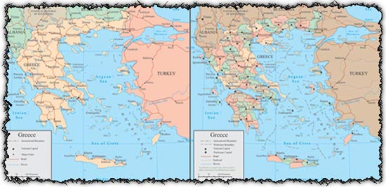
Description: This set comprises two Greece vector maps, providing comprehensive coverage of administrative divisions and geographical features. These maps are meticulously crafted to offer accurate representations of Greece’s territory, including administrative boundaries, cities, and topographical details.
Usage: Utilize these vector maps for a wide range of purposes, including educational materials, presentations, geographical analyses, and cartographic projects. Whether you’re creating maps for print or digital media, these vectors offer flexibility and scalability, allowing you to customize and annotate them as needed.
Download: Access the AI files and JPG previews to incorporate these Greece vector maps into your projects seamlessly. Enhance your visuals with detailed and visually appealing maps that effectively convey information about Greece’s geography and administrative structure.
HELLO, PLEASE TURN YOUR ADBLOCK OFF IN ORDER TO DOWNLOAD THE FILE!
It looks like you're using an ad blocker. That's okay—who doesn't? But without advertising income, we can't keep making this site awesome.





thank you for downloading this.
thanks