Argentina vector maps
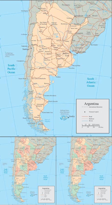
Description: Explore detailed vector maps of Argentina, including administrative divisions and geographical features. These maps provide comprehensive coverage of Argentina’s regions, provinces, and cities, making them valuable tools for various purposes, from educational presentations to business analyses and travel planning. With high-quality vector graphics, these maps are scalable and customizable, allowing you to zoom in for detailed views or incorporate them into your designs without loss of quality.
Usage: Use these vector maps for a wide range of applications, such as educational materials, geographic analyses, urban planning projects, and marketing presentations. They’re suitable for digital and print use, so you can include them in websites, reports, brochures, posters, and more. Whether you’re studying Argentina’s geography, planning a trip, or conducting business in the region, these maps offer valuable insights and visual aids.
Download: Access the vector files to explore the detailed boundaries, labels, and geographical features of Argentina. With these maps, you can gain a better understanding of Argentina’s geography and demographics, helping you make informed decisions and effectively communicate information about the country. Download now to enhance your projects with accurate and customizable Argentina vector maps.
HELLO, PLEASE TURN YOUR ADBLOCK OFF IN ORDER TO DOWNLOAD THE FILE!
It looks like you're using an ad blocker. That's okay—who doesn't? But without advertising income, we can't keep making this site awesome.


Leave a Reply