Afganistan map – 3d, administrative and major cities
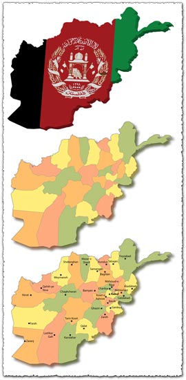
Description: Explore Afghanistan with this comprehensive map set, featuring 3D, administrative, and major cities representations. From its rugged mountain ranges to bustling urban centers, these maps provide a detailed overview of Afghanistan’s geographical and administrative features.
Usage: Use these maps for educational purposes, presentations, or geographic analysis. The 3D map offers a unique perspective on Afghanistan’s topography, while the administrative map provides insight into its political divisions. The inclusion of major cities helps users understand the country’s urban layout and population centers.
Download: Access the AI file compatible with Adobe Illustrator CS4 and the JPG preview images of the Afghanistan maps. These resources allow you to explore Afghanistan’s geography and administrative regions with ease, making them valuable assets for various projects and presentations.
HELLO, PLEASE TURN YOUR ADBLOCK OFF IN ORDER TO DOWNLOAD THE FILE!
It looks like you're using an ad blocker. That's okay—who doesn't? But without advertising income, we can't keep making this site awesome.


Leave a Reply